Posts

Out and about in the "Outback" around North Ranch--and It IS a Small World!
Image
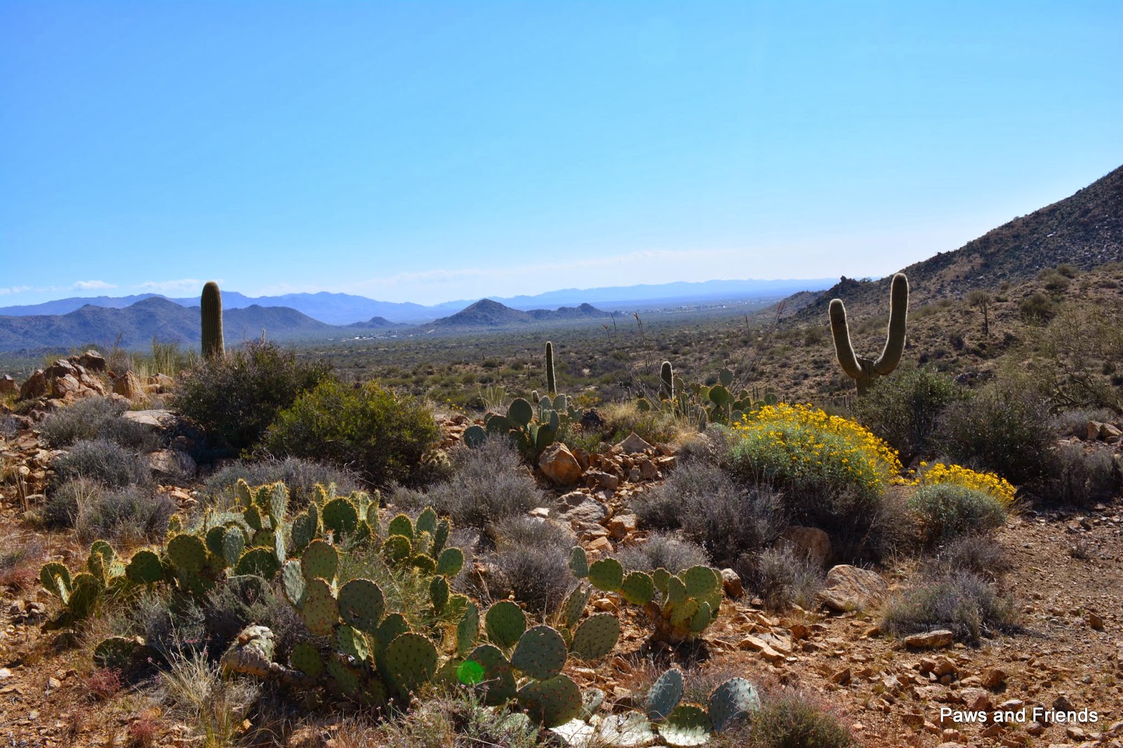
View just west of House Rock--looking east towards Congress Okay, here we are near the end of March 2014....and it has been 26 days since any updates have been posted here....! The weather has been glorious! Sunny days and cool nights. We have even felt a little guilty (REALLY!) watching the weather across the US, while we have been enjoying such beautiful weather just House Rock north of the Valley of the Sun, here at North Ranch.  We have been busy  planning our spring and summer travels, as well as entertaining "guests" and taking trips into new areas  of our Arizona "Outback" with our 4 seater side-by-side we call the Blue Buggy. Late February a friend took us out to "House Rock," north west of Congress. We found ourselves in terrain similar to that of the Superstition Mountains, an area we fell in love with during our first Paws and Friends "under" House Rock winter season in Apache Junction, AZ before full timing. Following ...

Hassayampa River Preserve

Image
If you are a frequent visitor to this blog, you know that we do love history and this area around Wickenburg is rich with history! There are the first people, first settlers: the Yavapai. Then there is "recent" history, the 1860's, in the Congress area, when a massive gold deposit was found in a place they named Rich Hill. This brought many gold seekers to the Valley of the Hassayampa which continues to this day! Many residents of North Ranch spend their time out in the hills to the north east gathering buckets of dirt which they bring back and run through their temporary wash--hunting for gold dust.... We just enjoy the scenery! So, after traveling by this Preserve , part of the Nature Conservancy, many times these past two years, we finally stopped mid January for a visit! It was a treat! See for yourselves! Here are some pictures of our visit. Its history goes back to the "recent" history of this area--after the gold seekers settled down to ranching in the ...

Adding to our Pin Collection with Reflections...

Image
First row on 2014 almost complete! For any "new" readers, we collect pins of our travels and put them on a cork board mounted in our motor home. On June 13, 2013 , we posted about our pins, and our first posting was March 24, 2013 . Last of our travels in 2013... Look! It is just two months into 2014, and we have almost one row across! We start out this year with a snow flake "coin" from a handmade Christmas card from our dear friend Teresa. (Her cards ARE special!!) On our trip to Death Valley we collected eight! And of course we added one for the Super Super Bowl Champions, the Seattle Seahawks! In our travels the last "half' of 2013 we collected pins from the following: The Nez Pierce Historic Trail  Big Hole National Battlefield, just across the border from Clarkston, WA Lewis and Clark Trail (which we have been on in several areas of our journeys!) Hells Canyon National Recreation Area (we did not take the jet tour but did drive the j...

Death Valley Daze

Image
Here is our route we took from North Ranch to Death Valley, with a stop at a Passport America RV Park in Las Vegas. From Pahrump we took Bell Vista Avenue which becomes State Line Road to CA 127. Turn right on 127 then immediately left on CA 190, unless you want to stop and visit the Amergosa Opera House. Roads were good! View Larger Map                                                                               Spend some time exploring the National Park Web site. Here is a link to the National Park Web site , listing all the movies made there. Lindy often gets confused when trying to locate information, and in the midst of her confusion, finds rich information enriching our visit. Then again,  it just might be Lindy--you will be more attuned to the task! The full hook-ups at F...

Go Hawks!!!

Image
We left Death Valley for Pahrump, Nevada this morning--66 miles TO WATCH THE GAME. We had to play musical sites, as needed to find one that would get satellite TV.  Success, after the 3rd attempt! We are set up, and watching the pregame show! We are hoping for a win by our SEAHAWKS!  Coach all decked out with our flag that has been flying during each of their wins! After the game!!! Roving Riders, all set to support our team! G O S E A H A W K S !!!! SUPER BOWL CHAMPIONS!!!!!

In and Around Furnace Creek--Geocaching!!

Image
There is a bike trail from Furnace Creek Campground to Harmony Borax Works, about a mile one way. the Harmony Borax Works trail also goes south to Furnace Creek Ranch, passing the Visitor's Center. And Lindy found an Earthcache  at Harmony Borax Works--learning more about the history...--so of course we had to get our bikes out and ride! This was Wednesday afternoon, the 29th, and it was in the low 80's as we rode along the trail. However, there was a breeze, so it was comfortable weather for riding. The Harmony Borax Works was in operation for five years. But, they discovered that their process did not work effectively when the temperatures reached 120 degrees, so operations were suspended in the hottest days of the summer. They refined the Borax there, as more efficient for transport. Still, two wagons carrying 30 tons across 165 miles to the train was an awesome feat! Attached to the two huge wagons was an iron water tank--for obvious reasons! The wagons were usua...

Death Valley -- South East of Furnace Creek: Zabriskee Point and Dante's View

Image
Here is a link to a Virtual Museum Exhibit web page on Death Valley .  You can click there, then come back to this posting! We don't mind! We ARE enjoying our visit here! Wednesday, January 29, we drove south east for more exploration! Weather that day sunny and cool--warmed up to high 70's by afternoon. Zabriskie Point is off Hwy 190, just past the Furnace Creek Inn. We parked in the lot, and opened the rear windows and sunroof so the dogs would stay "cool"!  Actually, COLD was more like it, but good, as they always have their coats with them.... Since it was early in the morning, not too many people were there. We walked up to the view point and WOW!  We saw a stunning panorama view of the badlands near Furnace Creek, at the upper east end of a badlands terrain FULL of impressive canyons and gulches. Then, you turn west--down into the Badwater Basin, and across to Telescope Mountain, the highest peak in the park. Quite a view! But wait--there is more! Dan...