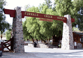
Ubehebe Crater, Scotty's Castle, Stovepipe Wells, Mesquite Dunes: Points North of Furnace Creek

This morning we packed a lunch, some snackies (human and dog) and lots of water and headed north from our camp site at Furnace Creek. Death Valley is defined by mountain ranges alternating with valley basins. Active fault lines trend north to south along the western and eastern mountain ranges of the Park. One side rises, as the other side falls, and in spite of the erosion washing into the basin, it continues to drop below sea level. We saw mountains on both sides of us as we drove north. This got Lindy really excited as she watched the strata in the mountains change from diagonal lines to straight up and down! She snapped way too many pictures! Here are a few that show this. We stopped at Ubehebe Crater , a large volcanic crater from what is called a maar volcano. With the Paws, we did little exploration. We understand in the 1 1/2 mile around the rim of the crater several smaller craters can be seen. If interested, click on the link for Ubehebe Crater. ...


